Between 1776 and 1875, the Portuguese Empire shifts its main axis of intervention from Brazilian
territories to Africa, aiming to strengthen territorial occupation and resolve the complicated
issue of slavery. According to most historiography, with the Brazilian cycle closed and despite the
successive reforms, the empire fell into a relative lethargy. However, it is precisely during this
period that we find an increasing concern by the authorities in calculate and control the population.
This effort came through and producedseveral hundreds of statistical
maps covering irregularly the various territories. Population statistics were a key instrument
in the construction of States and modern forms of colonialism. Knowledge and quantification
reinforced the control over territories and populations and led to new policies. The long process
of creating a legal framework and a bureaucratic apparatus, able to produce, collect and interpret
the numbers, allowed a first quantification and classification of overseas populations.
The statistics, its categories and production circuits demonstrate the intensity with which the
State grasped its territories and began building a new order. On one hand, the acquired knowledge
enabled the creation of models for occupation and classification of the territory. On the other,
it shaped the way these territories were perceived and how people imagine themselves.
For the Portuguese, the existence of a significant corpus of population
statistics available for the overseas empire, since mid-18th century has been generally disregarded
by historians and demographers. This project represents the first attempt to gather, process and
analyse the “statistical maps” enacted by royal order and to create reasonably reliable demographic
series and indicators for each of the Empire’s territories.
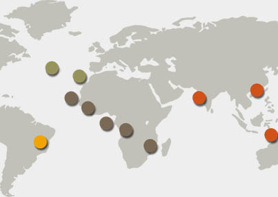
For this purpose, we will study the demographic tendencies for each
territory: Brazil (1776-1822), Azores and Madeira (1776-1834), Cape Verde, Guinea-Bissau, São
Tomé and Príncipe, Angola, Mozambique, Portuguese India, Macau (1776-1910) and Timor (1850-1875).
Depending on the available information, we will quantify: i) annual growth rates, territorial
division and urbanisation levels; ii) population structures (socio-professional, religious and
ethnic distribution, active population and age composition); iii) demographic behaviours (fertility,
mortality and migration balances).
In addition to the strictly demographic analysis, the project also
encompasses the study of the reasons that led the Crown and the Liberal State to order this
extensive set of maps. Thus, we may provide new data for the analysis of several policies tied to
Empire: territorial occupation, population management, taxation, conscription and the use of labour
force.
 What would the population of the Portuguese Empire have been in 1800 or 1850? How many
Europeans were there in Angola, or in Goa? Where was the enslaved population percentage higher?
This research aims to quantify and analyze the living conditions of the various ethnic,
religious, free, and non-free groups that existed in the Portuguese Empire.
The Counting Colonial Populations’ project goes far beyond numbers and quantification.
It aims to uncover new


